Whilst on holiday in Wales, we decided to try for a SOTA activation on GW/NW-001. As we went in October (14/10/2025), we were not sure what weather to expect, so made sure to check the forecast in advance. I used the mountain weather information service for the forecast: https://www.mwis.org.uk/. Although you could take shelter in the cafe at the top, we wanted to avoid being caught out in the rain and high wind.
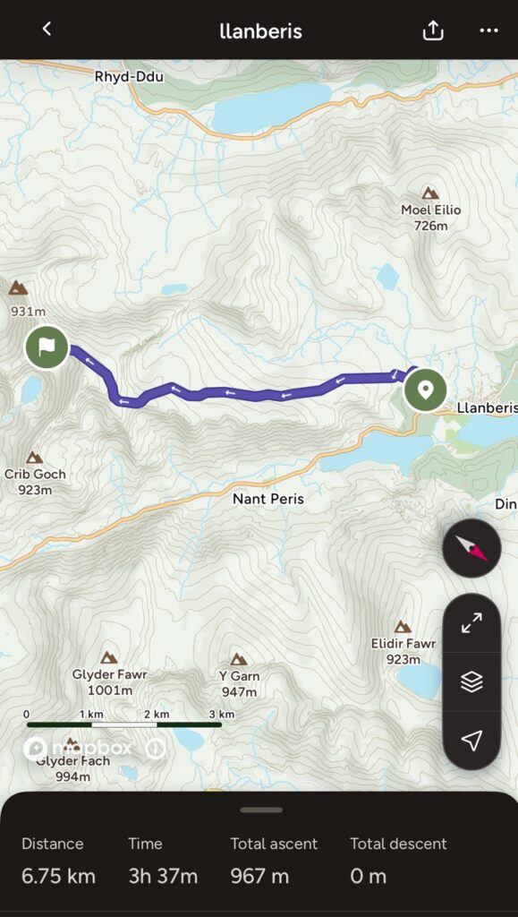
There are multiple routes up Yr Wyddfa / Snowdon, depending on how ambitious you want to be. You can use this website for a good overview of the different paths: https://www.visitsnowdonia.info/snowdon-walking-routes I chose to ascend on the miners path, as you are meant to get good views on the route, and the ascent itself is not too challenging.
If you want to park at the dedicated car park at the start of the miners path (or also for the Pyg track), you would need to pre-book a spot at the Pen y Pass car park https://www.justpark.com/uk/parking/caernarfon/s/llanberis-caernarfon-ll55-4nu/, which also costs 20 pounds. I wanted some spontaneity, in case the weather turned, so did not want to pre-book a space. Therefore, we used the bus instead. The sherpa bus network gets you to and from many locations in the national park, and is reasonably priced: https://www.sherparwyddfa.wales/. This also means you can be a bit more flexible, as you are not bound by finishing the hike where you parked your car.
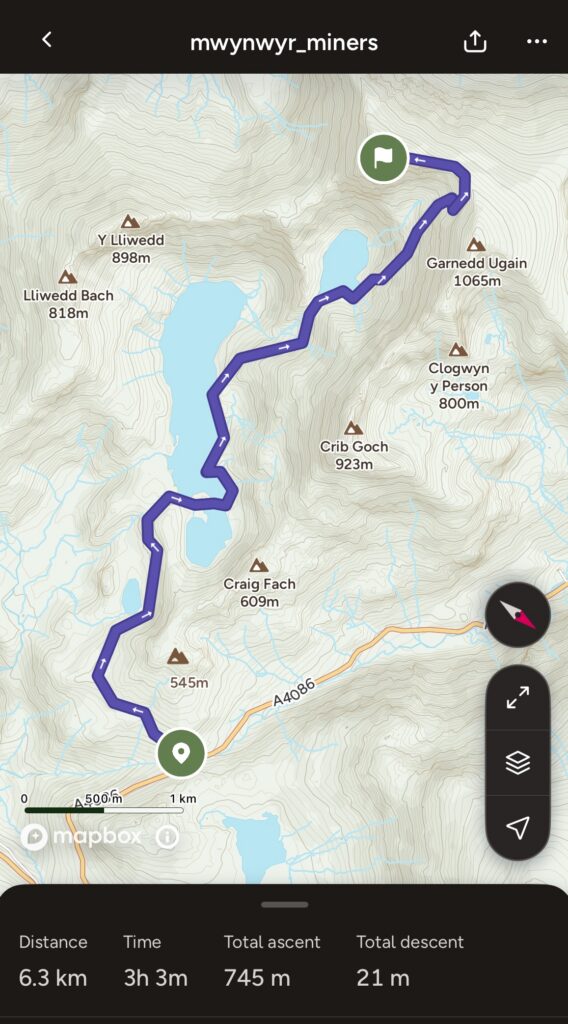
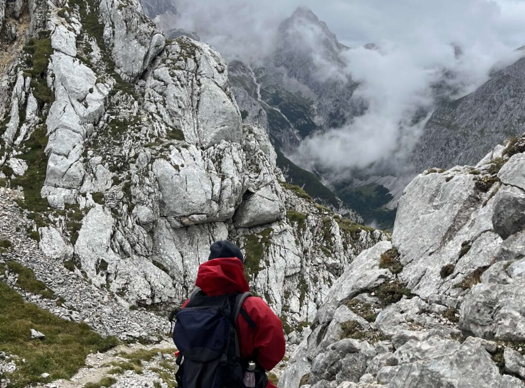
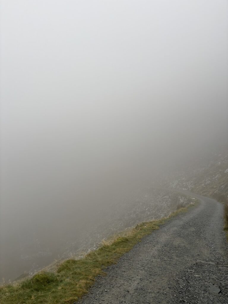
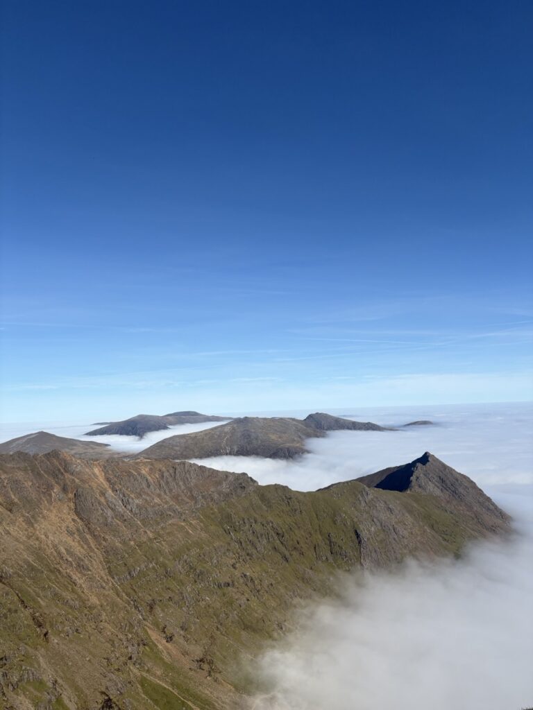
We started out in the morning on the miners path, and saw absolutely none of the good views as we were immediately inside a cloud! The path is well maintained, and starts off pretty flat and relaxed. As you start to ascend, the gravel gives way to rock, which can be a little slippery underfoot. It gets quite fun where the path ascends to join up with the Pyg track, as you need to clamber over some rocks. We lost the path a couple of times here, but it was relatively obvious to get back onto it. We started to move through the cloud at this point, and were greeted by blazing sun, and the first sight of the summit, looming up above the clouds.
Once the path joins up with the Pyg track, you have to follow a reasonably steep zig zag path of steps up to the top of the ridge. This joins up with the Llanberis path, so can be a bit busy with people going up and down, but at this point you are not far from the summit. You also walk next to train tracks, so get to see them chugging up and down. I had prepared to be cold and wet, but it was actually pleasantly warm at the summit, due to the cloud inversion. During an inversion, cold air is trapped under the warm air, so it got warmer as we ascended. As we approached the summit, looking for a place to set up the Yaesu ft-818nd, we heard someone else calling CQ SOTA on the Quansheng on 145.500, so were able to get a summit to summit before we had even sat down!
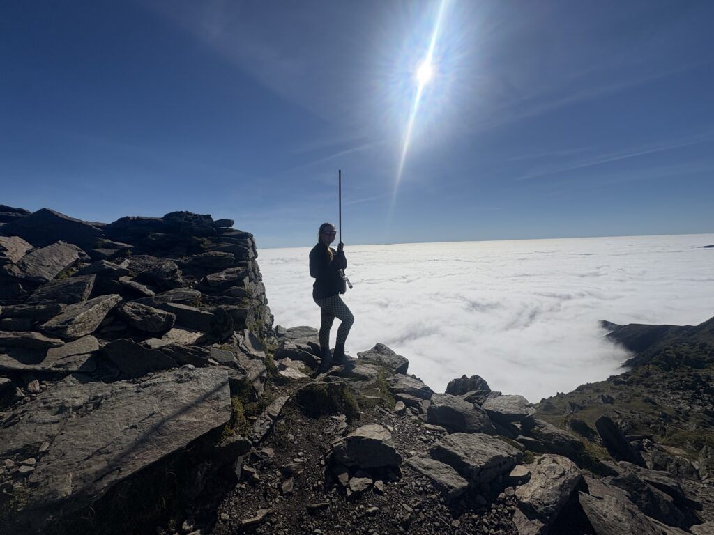
We decided to start with 2m, as this was, according to the SOTA website, the band with the most QSO’s for this summit https://sotl.as/summits/GW/NW-001. It’s also quick and easy to set up, compared to HF, as we just needed to attach the antenna to the radio, and not need to extend the mast. The summit is fairly busy, so we sat off to one side, just below it. I used the Yaesu ft-818nd, and a long abree antenna. To my surprise, I got a response very quickly after calling CQ SOTA and had a pile-up on 2m! After 10 QSO’s within 45 minutes, we decided to turn off the radio, and admire the views. The cloud inversion was just astonishing to look at!
As we had come by bus, we did not need to return to Pen Y Pass carpark, and could be flexible with the route down, depending on how we were feeling. We debated either descending via the Pyg track, or the Llanberis path. In the end, we decided to take the longer, yet more gentle, Llanberis path down the summit, as we wanted something relaxed. This was a lovely descent, ending in the town, (with the chance to get some refreshments before taking the bus). As we descended, I was struck by how steep the Llanberis path was in places, and how gruelling the slog up the mountain was (It is pretty much just a continuous up), so was pretty happy in our decision to take the miners track up.
Yr Wyddfa / Snowdon is worth considering if you do not fancy the walk up and down the mountain, as you can use the railway instead https://snowdonrailway.co.uk/. From the railway station, there are well maintained steps up to the summit itself, so if you do take this option, and want to go all the way to the very top, be prepared to do a small amount of stair climbing. The railway runs up and down from Llanberis, so you could also consider taking the railway up, and walking down, or vice versa. There is a cafe at the top, which, apart from offering refreshments, would offer some protection against the elements, if you happen to be up there in poor weather.